KEY POINTS
- Storms, urban encroachment and insufficient sediment supply have diminished sand dunes on the north coast of this U.S. territory
- Restoring the dunes is vital, as they protect the island from storm surge, serve as habitat for plants and animals
- Scientists are using satellite and aerial imagery to assess sediment distribution pathways
- Researchers to use findings to help other Caribbean ecosystems
BY GUS MORGAN
Across the road from the narrowed beach, ConocoPhillips sedimentologist Dallin Laycock noticed a sand dune, struggling to form in a grassy patch near a bus stop.
“Nature was desperately trying to put a dune where it would normally create it,” Laycock said, noting the road occupies the space where sand dunes would normally form.

This once expansive beach near San Juan, now half its original size, illustrates how coastal erosion and urban development are imperiling the island's coastal ecosystem.
As part of a collaborative effort to restore coastal sand dunes in Puerto Rico diminished by humans and nature, Laycock was surveying different beaches to gain clues as to why dunes restoration projects on the north side of the island were producing mixed results.
In his volunteer role, Laycock is lending his geological skills to the project, analyzing sediment flow along Puerto Rico’s northern coast using satellite and aerial imagery.
"We've been using satellite geology techniques to understand what is happening on the north shore of Puerto Rico," said Laycock, who has spent the majority of his career working as a sedimentology and stratigraphy specialist in unconventional reservoirs, mostly working on the Montney asset in Canada. Recently he moved to the Surmont asset to gain exposure to different types of reservoirs and the challenging world of SAGD operations.

Restoring a ‘delicate ecosystem’
The dunes, which function as natural barriers, protect the island’s residents from storms and serve as habitat for plants and animals, including endangered sea turtles that use them as nesting grounds.
“It’s a delicate ecosystem,” Laycock said, “and the loss of dunes has also impacted various plants and other creatures, not just the turtles.”
In 2017, two hurricanes devastated the sand dunes on the island’s north coast, followed by a 2018 winter storm that inflicted further damage on the fragile dune ecosystem. Erosion, dams that stop sediment flow to the ocean, foot traffic and all-terrain vehicles all pose a threat to the dunes. In the 1960s, illegal sand harvesting for construction projects contributed to the demise of many of the island’s coastal dunes, some of which towered more than 50 feet tall.

Scientists unite
Robert J. W. Mayer Arzuaga, a biology professor in the Department of Natural Sciences at the University of Puerto Rico Aguadilla, has been leading the charge to restore the dunes with the help of students and volunteers. While most of the dune restoration projects are going well, some have failed to produce sand accumulation.

To remedy this, Arzuaga, director of Vida Marina (also known as the Center of Coastal Conservation and Ecological Restoration) at the University of Puerto Rico at Aguadilla, recently connected with Laycock; Sean Fletcher, a sedimentologist; Richard MacKenzie, a senior geoscientist/geophysicist at Bureau of Ocean Energy Management (BOEM); and NASA geologist Paul Bremner for geological advice.
“He’s been trying to trap sand, but you have to know where it comes from and where it’s going to do that,” Laycock said. “So, we’ve been looking at the surrounding geology to help him understand how they can build these dunes properly. He hasn’t been working with a geologist, and he asked if we could help him understand how the dunes work.”
Ecological ambassadors
During the pandemic, Laycock and Fletcher started posting Google Earth images of interesting geological features on LinkedIn to engage geoscientists and inspire critical thinking.
- The “Satellite Geology” videos they created proved popular, generating thousands of views. Fletcher would post pictures of geological features on other planets and compare them to features on Earth. Richard MacKenzie from BOEM thought they were underutilizing their content. So he connected the duo to NASA geologist Paul Bremner, who then started collaborating with the sedimentologists to move their time-lapse videos onto the space agency's YouTube channel for additional exposure.
- Around the globe, educators have been sharing these geological videos and photos with their students, including professor Arzuaga, who reached out to Laycock and Fletcher, asking for geological assistance with the sand dunes restoration projects in Puerto Rico.

Satellite geology unlocks clues
To help with the dunes restoration project, Laycock and his colleagues have been assessing the dynamics of the island’s river channels and northern coastal system using Google Earth and aerial imagery.
"The biggest problem is sediment source," Laycock said. "So, with a better understanding of where the sediment comes from, and where it goes, we can dramatically increase the chances of success for restoring these delicate environments."
A network of dams along the rivers that feed sediment from the mountainous regions to the coast have disrupted the sediment supply to the island’s northern beaches, Laycock said, starving them of sediment.
“Sand on a beach doesn’t just move back and forth with the waves,” Laycock said. “The waves push the sand parallel down the beach, essentially creating a conveyor belt of sand. It’s a constant balance of deposition and erosion.”

A field trip nets more data
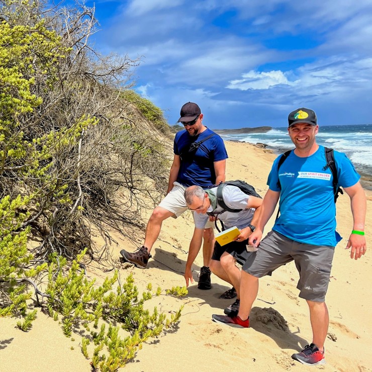
In late June, Laycock and Bremner traveled to the island to see the restoration projects firsthand and collect more data on seven beaches where restoration efforts are underway.
“Our field work should provide us with additional data to confirm what we were seeing on the satellite images and support our hypotheses or point us in another direction if needed,” Laycock said. “And our investigative work will help Robert understand how to build these sand dunes back for the turtles as fast as possible. We hope our learnings can be applied to many other beaches throughout the Caribbean and save lots of plants and animals.”
Developing sustainable solutions
Restoring ecosystems is a complex challenge, as everything is connected.
“You don’t want to replace one problem with another,” Laycock said.
Although the scientists can see the dams are limiting sediment flow to the coast, Laycock said it’s difficult to quantify. And formulating a solution that won't cause further harm requires careful consideration.
For example, Laycock said it may be possible to dredge the trapped sediment and put it on the other side of the dams so it can wash downstream and into the ocean. But that carries a risk, as the sediment could choke out reefs if the natural sediment flow rate is too great.
Biologists suspect another issue with relocating trapped sediment: Sea turtles may navigate to particular beaches with sand that has a magnetic signature. In Puerto Rico, the sediment on some of the beaches contains lots of magnetite, while others don’t have any. So dredging sediment from one location and transporting it to another spot may interfere with the sea turtles’ navigational abilities.

Advancing research, ecological restoration
Moving ahead, Laycock and others in their satellite geology group plan to publish a research paper highlighting the successes and failures of the restoration project and the role that sediment dispersal pathways play in creating sand dunes. The paper will include recommendations on how to improve dune restoration efforts, such as choosing the right locations for biomimicry efforts.
I’m hoping the learnings we get from Puerto Rico can be applied in other places.
“We have a good handle on how these sand dunes grow and where they like to grow,” he said. “The bigger question is how do you preserve them in the long term?”
The dunes restoration effort includes an environmental education component, a way to spread awareness about the importance of ecological restoration of coastal areas and inspire the next generation of environmental professionals and advocates.
A high point of the trip, Laycock said, was getting to work with Arzuaga and his biology students, and having the opportunity to tell them more about the island's unique geological history.
“It was exciting engaging with the students,” Laycock said. “They helped us collect sediment samples and label bags, and they enjoyed showing us around. Many of them grew up on these beaches and had insight into the geology of the area.”
While there's more research to be done, Laycock said he's grateful to have been asked to join this ecological restoration effort. He said the resulting research will hopefully benefit other Caribbean ecosystems facing similar issues.
“The field trip was a success,” he said. “I’m hoping the learnings we get from Puerto Rico can be applied in other places. It feels great to be helping out, and I feel like I'm doing something that benefits the planet and the local population."

AT A GLANCE
NAME: Dallin Laycock
JOB TITLE: Explorationist; joined ConocoPhillips in 2014
EXPERTISE: Fine-grained sedimentology and stratigraphy
HOMETOWN: Calgary, Alberta
EDUCATION: B.S. Geology/Earth Science, Brigham Young University; PhD, Geology/Earth Science, University of Calgary; MBA, Quantic School of Business and Technology
FAST FACT: Co-author of Geology Unfolded: An Illustrated Guide to the Geology of Utah’s National Parks
QUICK QUOTE: “I’m driven by trying to be a source of positivity and support for all those around me.”


